

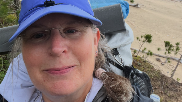
Here’s part five of my journey solo backpacking the North Country Trail in Upper Michigan.
As an Amazon Associate, I earn from qualifying purchases.
Who is Betsy Leighton?
I’m a writer, blogger, and healer dedicated to helping individuals reconnect with their innate peace and wholeness by healing nervous system dysregulation. My personal experience with chronic illness called Mast Cell Activation Syndrome (MCAS) shapes my work, and my content offers tools to empower those with chronic illness to improve their well-being and take charge of their health.
I created the Sacred Self-Healing Method and am a trained and certified Safe and Sound Protocol provider, an author, blogger, and A Course in Miracles Teacher. I hold a Master of Divinity in Spiritual Counseling and am a trained spiritual mentor, with certificates in sound healing, aromatherapy, nutrition, and Sacred Deathcare. I offer a self-study certificate program in the Sacred Self-Healing Method, provide spiritual counseling and coaching, courses, and supported subscriptions for the Safe and Sound Protocol.
What is MCAS?
Mast Cell Activation Syndrome (MCAS) is a chronic condition that affects all organ systems. It can cause severe, disabling symptoms every day, including potentially fatal anaphylaxis.
The common triggers for MCAS are infections, toxic exposures including mold exposure and EMFs, trauma, concussions, and stress.
MCAS often occurs with other chronic conditions like Ehlers-Danlos Syndrome (EDS) and Postural Orthostatic Tachycardia Syndrome (POTS). Managing MCAS is challenging because many healthcare providers are unaware of it, and diagnostic tests can be unreliable. Treatments include antihistamines and mast cell stabilizers in the form of medications and supplements, along with avoiding triggers. Check out this post on managing MCAS.
Why solo backpacking?
In 2024, I solo backpacked most of the Superior Hiking Trail and wrote a book about the experience. I have a chronic illness called Mast Cell Activation Syndrome (MCAS), which causes symptoms of severe inflammation, pain, and allergic-type reactions. I’ve managed my condition with dietary changes, antihistamines, and mast cell stabilizers. In solo backpacking, I’ve found a hobby that keeps me fit, challenges me, and actually helps me manage my symptoms. Over the past two years, I’ve gradually increased my exercise tolerance, starting from not being able to exercise at all. In June of 2024, I began solo backpacking the Superior Hiking Trail, and at that time, I could only walk one mile. As my stamina and strength grew, I increased my pack weight and mileage until I reached my furtherst daily distance of up to 38 miles.
I’ve done a lot of work to heal MCAS by treating infections and toxic mold exposure, improving my gut health, and retraining my nervous system. Along with those things, I found being in nature in sync with my circadian rhythm to be a huge piece of my healing path.
In 2025, I solo backpacked across northern Wisconsin in four sections on the NCT with the help of some trail angels who shuttled me from one trailhead to another. If you’re interested in reading about my past sections of the NCT, check out my blog: https://betsyleighton.com/solo-backpacking/
In 2026, I’m aiming to solo backpack the 550-mile section of the NCT in the Upper Peninsula of Michigan.
Why the North Country Trail?
The North Country Trail spans 4800 miles from North Dakota to Vermont, and traverses my home state of Minnesota. I was attracted to exploring the Superior Hiking Trail, which is a segment of the NCT in Minnesota, first because it holds fond memories from my childhood. But once I finished the SHT, I was hooked on solo backpacking and wanted to continue to explore the North Country Trail, where it picks up after the SHT at the Western border of Wisconsin. From there, I’ve set my sights on completing the entire NCT over the next few years, and I hope to solo backpack at least 500 miles per season.
Gear
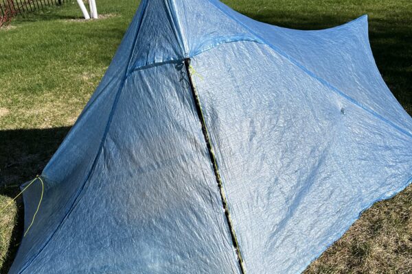
My backpack weight is usually about 20 pounds on a typical 3-day solo backpacking trip. My base weight is a little under 13 pounds–which includes my shelter (tent), sleep system (quilt, sleeping pad, inflatable pillow, etc.), and basic safety gear for first aid and gear repair. Food and water are the heaviest items in my pack, and they add another 7-10 pounds to my pack. You should really only carry 15% of your body weight on your back, so that limits what I can carry. I’ve tried a lot of different gear setups, and have found that with my petite 5’2″ frame and weight, it works best for me to use ultralight backpacking gear. You can check out my gear list here.
Sewing
With MCAS, I react to many fabrics, scents, foods, and textures. I’ve sewn a lot of my own backpacking clothing because it allows me to use the fabrics I tolerate and create fits that suit my style and comfort. You can check out my sewing projects here.
Tolerating exercise
This post covers the unique challenges to exercising when you have a chronic illness and offers tips and tricks I’ve found to make it work when you have physical limitations.
Part 5 solo backpacking the NCT MI-UP
Day 16: Solo Backpacking the NCT MI-UP – Grand Marais Woodland Campground to Blind Sucker River – Daily mileage: 12.93, Running Total: 776.14 – So. Many. Blueberries.
Monday, I drove to Muskallonge Lake State Park Campground, a journey that took 8.5 hours—longer than any previous drive as I’ve moved further east and covered more miles in the Upper Peninsula. I still have one section West of Marquette between the Little Garlic River and Lake of the Clouds, but I decided to focus on shoreline miles in this section because it’s been so hot.
The air quality was poor during the drive, peaking near Green Bay at an AQI over 250. By the time I arrived at the campground, it had dropped to around 100.
The power was out at the campground due to a recent storm. Winds from the south were strong—gusts reaching 30 mph—creating unstable conditions. While I was in the bathroom, another camper alerted me to a tornado warning. Fortunately, it was a false alarm. Power resumed about an hour after I set up camp, allowing me to use the hot water and WiFi to text my family.
The night was quiet with light rain, and the wind gradually died down, shifting to the west. By morning, the sky was overcast, and the AQI had dropped to 50. I’d closely monitored the air quality before departure. I had followed Tara Atkinson’s recent harrowing experience last week, when she had to self-evacuate from the Border Route Trail in the Boundary Waters Area of MN due to extreme heat and smoke. Thankfully, she escaped safely and is now hiking west of Grand Rapids, while fires in northern Minnesota continue to burn.
Tuesday morning, I drove to the Mouth of the Two Hearted River via rough dirt roads. I organized my gear and read my book while waiting for my shuttle driver. It arrived half an hour late—my concern grew that it might not show up at all, and I had no cell signal to communicate with them. But by 8:30 a.m., we were on the road heading toward Grand Marais. MI.
This section spans 40 miles between Grand Marais and the river’s mouth. I’ll wild camp tonight in Newberry State Forest—a much simpler setup than the last section when I had so much trouble booking campsites. On Wednesday night, I’ll tent camp again at Muskallonge State Park before returning to my car on Thursday. The weather was surprisingly cool—60s—compared to the 90s back home. It felt refreshing to breathe clean air and cool down after the oppressive heat and smoke of the past week.
The shuttle dropped me just outside Grand Marais, letting me avoid the 2-mile road walk out of town. As I entered the woods, there had been no recent rain since yesterday, but the foliage was still saturated, and droplets dripped down, soaking my shoes quickly. After settling into my usual hiking pace of about 2.5 miles per hour, I realized the trail was lined with blueberries.
For the next several miles, my pace slowed significantly, as I indulged in a generous, all-you-can-eat blueberry buffet. Wild blueberries are so good!!!
The day was cool, overcast, and breezy. The wind was so strong that by mile six, near Lake Superior, I had to hold my hat in place—it was blowing off constantly. Yet the breeze was a welcome relief from the bugs in the woods.
The abundance of blueberries continued, and by 2 p.m., I’d eaten so many that I developed a stomachache. I found a flat spot to pitch my tent, and I rested. There were so many blueberries that I couldn’t avoid pitching my tent directly on some berry bushes. It was surreal—never have I seen such a dense, wild blueberry patch. I felt a deep pang of regret passing by them without picking or eating. But with miles still to go, I left them for the bears.
After cresting the overlook on the Blind Sucker Pathway, I sat down at a picnic table to rest. I’d now completed 14 miles—just the minimum I’d hoped for—and planned to stop at the next suitable campsite I found.
Halfway down the ridge on the other side, I discovered a clear, flat spot that seemed ideal for overnight camping. It was far enough from the river that I couldn’t hear water or smell it, indicating it would be dry. It was also far enough from Lake Superior that I could hear the distant rush of waves, but close enough to feel the wind. Given these factors, it felt like a safe and well-located spot.
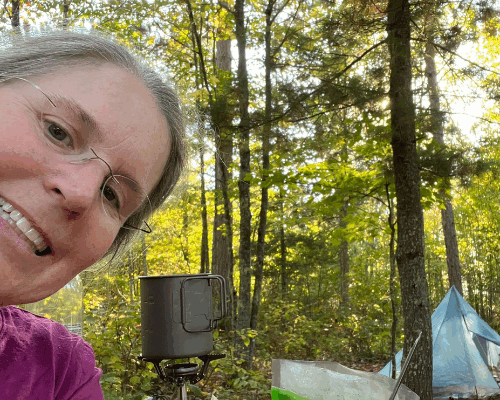
I settled into my tent, ate dinner, brushed my teeth, and read my book until bedtime. A gentle breeze carried through the night. I felt secure, safe, and deeply at ease.
Day 17: Solo Backpacking the NCT MI-UP – Newberry Forest to Muskallonge Lake State Park – Daily mileage: 14.54, Running Total: 790.68 – ORVers
I had a choppy sleep that night, and I wasn’t sure exactly why. I woke up every 45 minutes—perhaps I was on high alert, listening to the sounds around me. I don’t know. But by 5 a.m., I finally woke up fully and packed up my gear. I ate breakfast and set off east on the trail. After a brief descent through the Blind Sucker Pathway, I crossed a dirt road and suddenly found myself back at Lake Superior. It’s always breathtaking to emerge from the woods and see the lake—crashing waves, endless blue water, and a stiff wind kicking up whitecaps. The wind was so strong it felt like my backpack was being pushed along the trail like a sail.
After each section, I inspect all my gear, clean everything, and patch any tears. Last time, my net pants took a beating, and I had to sew mesh patches onto them. This time, I’ll be fixing a tear in my rain pants. Before this section, I also sewed a new graphene sun hoodie—long sleeves with a thumb hole so my hands can stay covered. I didn’t use a sewing pattern for the mitts, so it’s a bit rough—still a prototype. Once I’m home, I’ll use graphene fabric to attach proper mittens to the hoodie. It’s easy to lose small gear like mittens, so attaching them to my sun hoodie will reduce that worry. And I’m continually amazed at how mosquitoes can’t bite through graphene fabric. Even though it gets extremely stinky compared to Merino wool, it far outperforms in bug resistance—and is also excellent at blocking UV rays.
It was a gorgeous day. I filmed the sunrise over the lake and the waves crashing on shore. After the wooded stretch leading to the lake, I’ll be hiking along the shoreline—my favorite part of the day. I’m truly in love with this lake.
I’ve had no cell signal since my drive up two days ago, so I haven’t been able to get a full weather report. But I’m deeply grateful that the smoky air cleared. I’m breathing some of the cleanest air coming off Lake Superior. I’m so thankful that despite the fires still burning in the Boundary Waters and in Canada, this smoke-free moment is a rare gift and a blessing.
Along this stretch of shoreline, the vegetation is dominated by oak saplings, ferns, white pines, huckleberries (unripe), and blueberries. It’s a pleasant mix—no heavy grasses or weeds that catch on my clothes, and the plants dry out quickly with a breeze. Yesterday, some vegetation still held moisture from Monday’s heavy rain, soaking through my shoes. But thanks to the overnight breeze, they dried completely. Today, everything is dry, making for my ideal backpacking conditions with dry feet.
I didn’t see any other hikers during this section. When I parked Tuesday morning at the mouth of the Two Hearted River, the only other vehicles belonged to a rock hunter—she left with a long-handled rock grabber and baskets—and a fisherman. Many of the remote campsites along the shore are designed for what locals in Michigan call “ORV-ers”—outdoor recreational vehicle users.
The remote backcountry campsites along the shoreline are geared toward ORV-ers, and the surrounding areas are eroded due to tire damage. I could tell when approaching one: the blueberries were all picked over, and suddenly I started seeing trash everywhere. When I reached the Lake Superior campground—accessible by road by ORV or AWD vehicle—there was the usual mix of tents and vans. I stopped at a vacant site, used the picnic table to stretch, reorganized my pack, and tossed my trash into the bin. It was refreshing to have a clean, off-ground spot to rest and reorganize.
I noticed the previous campers had filled the fire ring with trash—including plastic bottles and bags—so I moved it 20 yards to the refuse bin as a small act of care. It’s disheartening to see how careless people are with our precious wild spaces. Fragile dune ecosystems are easily torn up by vehicle tires, leading to erosion and habitat loss.
This section of the trail is much better maintained than the last section I completed two weeks ago. Yesterday, I saw a trail crew clearing downed trees. The section has had fewer fallen trees despite recent storms—proof of care and maintenance.
By midmorning, I started smelling smoke on the breeze over the lake, and I worried about worsening air quality. My satellite device provided weather updates when I requested them, but it didn’t include air quality alerts.
Before arriving at Muscallonge Lake State Park, I weighed my options depending on the air quality forecast. If it worsened, I’d regroup at the state park, then push the 14 miles to my car. But after checking the forecast via WiFi at the campground, it looked safe to stay overnight.
I arrived at Muscallonge Lake State Park campground at 11 a.m. and set up my tent. I ate lunch, rested, and read my book. Every hour, I got up to walk around and keep my muscles loose—stretching, wading in the lake, snacking, and enjoying the day.
I ate dinner and rested until around 8 p.m., when I began to feel like I was suffocating inside my tent. A localized thermal inversion had trapped campfire smoke near the ground, and since I was lying on the ground, it became unbearable. I tried walking around, but the thick smoke made me nauseous, and I knew I couldn’t stay. So at 8:30 PM, I packed up and started booking down the trail, hoping to get as far as I could from the campfire smoke before dark. The sun set around 9:45 PM, so I didn’t have much time. I made it 2.5 miles, when I finally stopped smelling campfire smoke. I found a beach access point that looked promising and headed down into the dunes. It was slightly sheltered from the wind, so I set up my tent and settled in for the night.
Day 18: Solo Backpacking the NCT MI-UP – Lake Superior Dunes to Mouth of Two Hearted River Campground – Daily mileage: 11.72, Running Total: 802.4 – Magic
The irony of last night was that I chose to stay at the campground because it seemed like a safe, accessible option—there was no urgent need to try to outrun worsening air quality from the Canadian wildfires. But it turned out that the air quality at the campground itself was unbearable. You just never know!
I slept well at my campsite on the dunes, better than I have on any other part of this section. I left my tent flap open with the zipper unzipped so I could look out and watch the stars. As the sun dipped below the horizon, the western sky turned pink, then darkened, and the stars emerged one by one. I felt completely safe and protected there.
I awoke just before 5 a.m. at first flight, and began packing up for the final 11 miles to my car. From my open tent flap, I saw the eastern sky turn pink over the lake—a mirror of the sunset I had witnessed the night before.
After scrambling up the dune to the trail, I resumed hiking. Along this stretch, there were seven points where the trail detoured from the shoreline to skirt around private property. I completed the first detour last night, and before reaching the second, I passed through an unoccupied ORV campsite. As I passed by, I noticed a whole butternut squash left on a post by campers who had recently abandoned their site. Hmm. So much for deterring bears from campsites.
A mile later, I saw a used condom hanging on a tree branch. Then I passed another unoccupied remote ORV campsite, with the fire pit stuffed full of Styrofoam takeout containers. I didn’t take photos.
It’s hard not to feel judgmental toward the ORV users of these spaces, because wherever they go, they disrupt the delicate web of life that holds together lichen, mycelium, and a thin layer of rich, black topsoil. That fragile net is completely obliterated by their all-terrain tires in these areas, and the trail turns into loose sand, difficult to walk because you get so little purchase. Where the ORV users can’t go, the trail remains in pristine condition. I was reminded of the wise words of my kind and non-judgemental CLWS colleague, Leah Welch, who would often say, ‘There are just so many different ways of being in the world.’
Today’s theme was magic. There were blue skies, a beautiful breeze coming off the lake, and the blueberries were so abundant in this section that I stopped and picked a pint to fill my cold-soak jar in under five minutes. Whenever I felt hungry, I grabbed another handful of berries from beside the trail.
I was overwhelmed by the beauty of the remote areas. Yet, you can’t truly appreciate beauty without understanding its opposite. There’s a stark contrast between the 95+% of the trail that remains untouched and the less than 5% that has been desecrated by ORVers. The scattered remnants of toilet paper blowing in the wind are balanced by the pristine sections of unspoiled trail. The miles of shaded blueberry bushes that haven’t ripened contrast with the sunlit patches where thousands of berries are ripe and abundant. This duality—of beauty vs. littering, order vs. chaos, cool breezes at the shore vs. oppressive mosquitoes inland—gave me perspective and fueled my sense of wonder.
Other than occasional ORV users, I had not seen anyone else on this section. The trail had been erased of footprints by Monday’s heavy rain, and mine were the only footprints on the trail for 40 miles. The final detour was a doozy, and the bugs were miserable inland in the hot woods. When I finally emerged at the shore for the last time, I stripped off all my clothes and jumped into Lake Superior. It was heaven!
The final three miles of the trail followed ORV roads through the dunes that were really difficult to walk because they were just fluffy sand. I chose to walk the rocky beach in the water instead, and it was so much more pleasant.
Once back at my car, I got organized, showered at the campground, and began the 9+ hour drive home. My remaining UP-MI sections include 192 miles between Lake of the Clouds and the Little Garlic River, and 126 miles between the Mouth of the Two Hearted River and the Mackinac Bridge in St. Ignace.
The bucket theory
The bucket theory simplifies understanding symptom reactions with MCAS. Imagine your body as an empty bucket you don’t want to overflow. Reactions to various stimuli fill the histamine bucket at different rates, forming the total histamine level (how full your bucket is). More histamine means more symptoms. By managing triggers, reducing exposures, and taking medications and supplements, you can control your bucket’s level.
Know your typical symptom progression
Understanding your symptom progression during a flare is key to developing your rescue plan. This post discusses how to recognize symptom progression so you can be prepared to address them.
Get my free ebook, symptom log, and meal plan!
Want a tool to easily track your symptoms?
Check out these circadian health tools!
I’m an affiliate with Bon Charge, a company that makes tools for circadian health, and you can receive 15% off your order with my coupon code BETSYL.
Bon Charge offers tools such as yellow– and red-tone blue-blocking glasses, red light therapy devices, PEMF mats, infrared saunas, and EMF-blocking products.
Sign up for the SSP!
I’ve found the Safe and Sound Protocol (SSP) to be the most helpful bottom-up healing strategy if your nervous system has been overloaded with toxic exposures, including mold or non-native EMFs, chronic infections, concussions, stress, or trauma. The SSP is a passive listening therapy that helps heal nervous system dysregulation. Many people with MCAS and other chronic conditions have nervous system dysregulation stemming from infections, toxic exposures, concussions, and trauma. The SSP is an easy-to-use app that lets you listen to specially filtered music for 30 minutes each day as part of a 5-hour cycle. Studies show the SSP has a profound effect on mental health and chronic conditions. Here’s a short podcast describing the Safe and Sound Protocol.
You can sign up for the SSP here!
Heal your mind!
While the SSP is a bottom-up, somatic therapy for healing the nervous system, the Sacred Self-Healing Method I offer is a top-down nervous system-healing modality that focuses on cognition, attention, perception, and emotion, using the mind’s higher functions. The SSP and the Sacred Self-Healing Method complement each other and together produce lasting results. Here’s a short podcast on my self-healing practice.
I provide one-on-one in-person and remote chronic illness and caregiver coaching, as well as Sacred Self-Healing Sessions based on the Sacred Self-Healing Method, a proven, novel co-creative healing modality detailed in my Books.
Order my books!
Here’s a short podcast highlighting my five books.
My latest book, Living In The Light: Healing with Forgiveness, Sound, and Light, is all about the tools that have been most helpful for me to heal: forgiveness, sound, through nervous system retraining using the Safe and Sound Protocol, and light, through entraining my circadian rhythm with the energy of the sun. Living In The Light is available here!
Rocks and Roots chronicles my solo backpacking journey on the Superior Hiking Trail and my efforts to overcome nervous system dysregulation, gut dysbiosis, and Mast Cell Activation Syndrome symptoms to complete the 328-mile hike successfully.
The Sacred Self-Healing Method ebook is available here and in most ebook retailers!
The Sacred Self-Healing Workbook is available for purchase here!
Betsy’s first book, Sacred Self-Healing: Finding Peace Through Forgiveness, is available here
Companion Recordings
The companion audio recordings of chants, guided meditations, and sound healing demonstrations that accompany the Sacred Self-Healing Method are available for free on my YouTube channel here
What do you think?
I’d love to have your reply below!
Disclaimer
The preceding material does not constitute medical advice. This information is for information purposes only and is not intended to be a substitute for professional medical advice, diagnosis, cure, or treatment.