
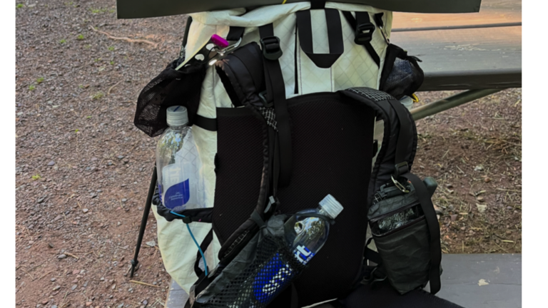
I had not added up my mileage since starting to solo backpack the Upper Peninsula of Michigan, and as of the end of this section, I’ve covered 763 miles on the North Country Trail. This post describes Part 4 of solo backpacking in MI UP between Copper Peak and Lake of the Clouds.
As an Amazon Associate, I earn from qualifying purchases.
Why solo backpacking?
In 2024, I solo backpacked most of the Superior Hiking Trail and wrote a book about the experience. I have a chronic illness called Mast Cell Activation Syndrome (MCAS), which causes symptoms of severe inflammation, pain, and allergic-type reactions. I’ve managed my condition with dietary changes, antihistamines, and mast cell stabilizers. In solo backpacking, I’ve found a hobby that keeps me fit, challenges me, and actually helps me manage my symptoms. Over the past two years, I’ve gradually increased my exercise tolerance, starting from not being able to exercise at all. In June of 2024, I began solo backpacking the Superior Hiking Trail, and at that time, I could only walk one mile. As my stamina and strength grew, I increased my pack weight and mileage until I reached my furtherst daily distance of up to 38 miles.
I’ve done a lot of work to heal MCAS by treating infections and toxic mold exposure, improving my gut health, and retraining my nervous system. Along with those things, I found being in nature in sync with my circadian rhythm to be a huge piece of my healing path.
In 2025, I solo backpacked across northern Wisconsin in four sections on the NCT with the help of some trail angels who shuttled me from one trailhead to another. If you’re interested in reading about my past sections of the NCT, check out my blog: https://betsyleighton.com/solo-backpacking/
In 2026, I’m aiming to solo backpack the 550-mile section of the NCT in the Upper Peninsula of Michigan.
Why the North Country Trail?
The North Country Trail spans 4800 miles from North Dakota to Vermont, and traverses my home state of Minnesota. I was attracted to exploring the Superior Hiking Trail, which is a segment of the NCT in Minnesota, first because it holds fond memories from my childhood. But once I finished the SHT, I was hooked on solo backpacking and wanted to continue to explore the North Country Trail, where it picks up after the SHT at the Western border of Wisconsin. From there, I’ve set my sights on completing the entire NCT over the next few years, and I hope to solo backpack at least 500 miles per season.
Gear
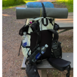
My backpack weight is usually about 20 pounds on a typical 3-day solo backpacking trip. My base weight is a little under 13 pounds–which includes my shelter (tent), sleep system (quilt, sleeping pad, inflatable pillow, etc.), and basic safety gear for first aid and gear repair. Food and water are the heaviest items in my pack, and they add another 7-10 pounds to my pack. You should really only carry 15% of your body weight on your back, so that limits what I can carry. I’ve tried a lot of different gear setups, and have found that with my petite 5’2″ frame and weight, it works best for me to use ultralight backpacking gear. You can check out my gear list here.
Sewing
With MCAS, I react to many fabrics, scents, foods, and textures. I’ve sewn a lot of my own backpacking clothing because it allows me to use the fabrics I tolerate and create fits that suit my style and comfort. You can check out my sewing projects here.
Tolerating exercise
This post covers the unique challenges to exercising when you have a chronic illness and offers tips and tricks I’ve found to make it work when you have physical limitations.
Part 4 of Solo Backpacking MI UP
Day 13: Solo Backpacking the NCT MI-UP – Copper Peak to Black River Harbor – Daily mileage: 8.14, Running Total: 732.62 – Dank Forest
While camped at Lake of the Clouds in the Porcupine Mts., it started raining during the night at about 2:30 AM, and it rained off and on for a couple of hours. At 4 AM, it was raining pretty hard, so I got up, put on my gear, and hiked out to my car. At my car, I spread out my tent to try to get it to dry and ate breakfast. I wasn’t expecting Susan, my shuttle driver, until 9 AM, so I had a few hours to kill as it steadily continued to rain. I drove into Silver City to try to get gas, but the gas station was not open, so then I just drove back to the Lake of the Clouds parking lot to read my book and wait for Susan.
Susan and I had a little trouble texting each other because I was in and out of cell signal several times. I walked up to the escarpment a couple of times to get better cell signal. We had arranged to meet at 9 AM, but with the time change and her being up early and ready to go, we ended up meeting at 8 AM.
The drive to Copper Peak with Susan was pleasant, as we had a lot in common in terms of interests in hiking and the outdoors, quilting, and knitting. She and her husband actually thru-hiked most of the Appalachian Trail several years ago, and it was fun to hear her story. Her husband was a forester who volunteered a lot on the NCT, and tragically, he died on the North Country Trail a few years ago. Susan told me there is a bench, dedicated in his honor, in the section east of Lake of the Clouds.
As soon as I got out of the car and started hiking, I entered a thick cloud of mosquitoes, so I quickly put on my protective clothing. It had rained on and off all morning, but as I started out, it had slowed down to sporadic drips. I was expecting to be wet most of the day, and possibly for this entire three-day section, but weather reports had varied so much it was hard to predict.
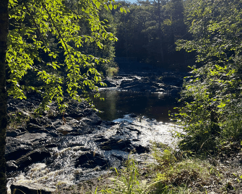
The riparian forest along the Black River toward Black River Harbor was shrouded in thick fog, as the roads had been on the way over. And it was dark and dripping, as rain was shed from the tree tops. Whenever I slowed down, I was attacked by mosquitoes, so I tried to just keep going at a steady pace. Every so often, I would catch a whiff of a fresh Lake Superior breeze that kept me motivated to keep going.
The trail tread was damp, but not too muddy, and lined with low maple saplings most of the way and wet sweetgrass, so my feet got very wet the last couple of miles.
After my Rocky night of sleep, I was feeling quite tired by the time I started hiking, but being in nature, moving at a steady pace, along with the vibrant green foliage, energized me.
I’ve been inspired to follow the solo backpacking journey of Tara Atkinson, who is thru-hiking the North Country Trail. Last summer, she completed the Eastern half, and this summer she’s doing the western half.
After reading many of her posts, I realized that Tara is truly a solo female backpacking beast. She has already completed the Continental Divide Trail, the Pacific Crest Trail, the Appalachian Trail, the Florida Trail, the Alabama Trail, the Arizona Trail, and several others. She has been working her way through all 11 national scenic heritage trails, and her goal is to complete them within a decade. It is so inspiring to watch her progress. She completed the upper Michigan portion of the NCT early this summer, before I had even gotten started, crossed Wisconsin on the section I did last summer, and is now working her way through the Superior Hiking Trail. It is such a joy to compare her reflections with mine on a similar journey, because there just aren’t that many solo female backpackers out there like us.
Along the Black River, I passed several waterfalls and overlooks. When I arrived at the Black River Harbor campground, I spread my gear out to dry and had a look around before I ate dinner and crashed in my tent for the night.
Day 14: Solo Backpacking the NCT MI-UP – Black River Harbor to Presque Isle – Daily mileage: 12.52, Running Total: 745.14 – Un-trailed trail
I woke about 7 AM at Black River Harbor feeling rested. It was good sleeping weather with clear skies and nice breezes to keep my tent ventilated and dry any damp clothing. My shoes and socks were still sodden from walking in the rain yesterday, and I was resigned to having wet feet again all day, so I just put on my wet shoes and socks and went about my morning.
After breakfast, I took the spur trail to the swinging bridge over the Black River and crossed over. The harbor lining the riverway looked very familiar to me, because my family used to sail from Bayfield to the Apostle Islands, Isle Royale, and along the south shore of Lake Superior. Funny story: I confirmed with my dad that Black River Harbor was where our boat was docked when it got struck by lightning while moored there when I was about ten years old. Nobody was harmed, but the boat suffered millions of tiny pinprick holes in its hull, and all the electronics were wiped out.
The trail continued upriver to Rainbow Falls, and the trail was wide and eroded from overuse. Shortly after that, the trail became narrow again. I stopped to collect water above Rainbow Falls, and then, as I was rejoining the trail, I realized there were a couple of large and unavoidable patches of poison ivy. I did my best not to touch it, but it was too thick to completely avoid.
After that, the trail became very disused and unmaintained. Saplings were overlapping the trail that reached over my head, tons of blowdown trees to navigate around over or under, and my pace slowed down tremendously as I tried to navigate that section. There was also a washout with unstable footing and several creek crossings, making it hard to travel fast. The poorly maintained sections of the trail are so dank and buggy that I’ve been continuously wearing my rain/wind gear, including my rain mittens, because the bugs are so bad. It’s hot and uncomfortable in many places.
Leaving the Ottawa National Forest, I followed blue blazes and entered the woods on what was supposed to be an ATV trail. Immediately, I realized that I was struggling. The section of trail was marked with flags and blue blazes from tree to tree, but there was absolutely no trail connecting the markings. I was bushwhacking through saplings over my head, constantly being whipped by branches, and quickly losing steam. It was hot, extremely buggy, and in many places, I could not find the next marked tree, and I had to backtrack and go in widening circles to try to find the next marker. I was traversing parallel to the ATV trail, but I realized this must have been marked for a future trail build and was not ready for hiking.
When I got to the point where I could not find the next marked tree, I used my compass and navigated over to the ATV trail. I had wasted at least an hour, struggling through the section. I had lost my head net when it got snagged on a branch, and I tried to backtrack and look for it, but could not find it. All in all, it was a complete shit show of an hour that I deeply regretted. I wished I had just followed the ATV trail.
Once on the ATV trail, it continued straight for a couple of miles until it crossed County Highway 519. After the road crossing, I again lost the trail as it entered the woods. I was at my mental limit by then, and returned to walk the road for the remainder of the 6 miles to the Presque Isle campground to preserve my sanity.
Pleasantly, when I entered the campground, there was a ranger shack with staff to ask my questions. I found out where the potable water was, the trash, my campsite, and confirmed that the bridge I needed to cross over Manabeznho Falls was in order.
I set up camp, collected water, and then lazed in my tent for the rest of the day, recovering from the bushwhacking ordeal. After spending the whole day hiking 13 miles in sopping, wet shoes, I was noticing a hotspot on the bottom of my right foot. I very seldom get blisters even on long-distance sections, but when your feet are sopping wet all day long as they have been for two days now, your skin starts to degrade.
There were actually two bars of cell signal when I walked close to the lake, so I called David for the first time on this trip. It was great to hear his voice and get encouragement after my rough day, and to catch up on what’s happening at home. The cell signal was pretty spotty, though, and the call dropped a couple of times.
After dinner, a woman from a nearby campsite came over and told me that a bear had visited the campground the previous night, and she wanted to make sure I had taken proper care of my food. The signage in the park had indicated that there was frequent bear activity, and they advised storing food in vehicles. But since I didn’t have a vehicle, I hung my food in a tree with my hang kit. There was only one tree with suitable branches in my campsite, but I actually did a perfect bear hang, with the bag over 7 feet up the trunk, over 7 feet out on a branch, and cinched tightly to the branch. I was proud of it.
It was comfortable at the Presque Isle State Park campground, and I slept pretty well in my tent as it was clear and breezy.
Day 15: Solo Backpacking the NCT MI-UP – Presque Isle to Lake of the Clouds – Daily mileage: 18.07, Running Total: 763.21 – Threat
I woke up feeling refreshed at 5:30 AM on Friday, packed up, and ate breakfast. Then I put Louko tape on what were now two hotspots on my right foot–one on the ball of my foot, and one directly above it. As I was leaving Presque Isle and pulling out my rain mittens to cover my hands against mosquitoes, I found my bug head net! Apparently, I had shoved it into my water bottle sleeve during the bushwhacking ordeal yesterday, so that was a delight.
The first 3 miles went by fairly quickly. Throughout this whole section hike, I have not seen any other long-distance hikers. And I was the only walk-in camper at both the Black River Harbor and the Presque Isle campgrounds. Occasionally, I saw size 12 men’s hiking boot prints in the mud going eastward, and so I knew there was somebody out here ahead of me, but I never saw them.
The Black River Campground was very quiet. It’s a national Forest campground, and even though there were several RVs camped there, the sites were spaced far enough apart that it was peaceful.
At the Presque Isle Campground, which is state-run, the sites are much closer together. With every RV running its generator for an hour each day, it got pretty noisy.
I covered 8 miles from Presque Isle State Park campground to the Big Carp River, where it flows into Lake Superior. I stopped, rested, aired out my feet and my shoes, snacked, and then forded the river barefoot.
I mentioned the solo backpacker Tara Atkinson yesterday, and I’ve learned a few things from her that have really made this section more pleasant. The first is that she’s a tea drinker like me, and she makes “moon tea”. I usually carry a stove, a fuel canister, and a titanium pot that I use to make my tea, and it takes time in the morning, when I want to be getting out of camp quickly. Tara wrote about how she soaks her teabags overnight in a jar with cold water, similar to making sun tea, just at night. Thus, “moon tea.” A lot of ultralight backpackers use cold soaking as a food preparation technique, which saves on the weight of a stove, fuel, and pot. You just use a plastic jar with a lid to cold-soak your meals in water instead of boiling water to rehydrate them. It works well for things like oatmeal, couscous, pasta, rice, etc, but I had never considered using it to make tea until Tara mentioned it. So, on this trip, I’ve been placing my teabags in my cold-soak jar at dinner time with a cup of water, and then by morning, I’ve got my delicious cold-brewed tea ready to go.
The other thing I learned about from Tara was single-serve steamed sweet potato strips. They are chewy like jerky, sweet, and full of carbs for tons of energy. I’ve been really loving them this trip. I have a lot of food sensitivities that limit my food options on the trail, so I’m always looking for new foods that I can tolerate that are delicious and easy to eat while on the move.
I decided to take the alternate along the Lake Superior Trail, which hugs the shoreline. As I was passing one of the remote campsites along the shore, I suddenly had an intuition that I wasn’t safe. All at once, I heard several rowdy male voices who were clearly under the influence, and I heard one of them yell the words “F**king whore!” My body kicked into overdrive, and without a second thought, I just started running down the trail away from them as fast as I could. I did not stop to assess the threat; I just got out of there. So even though I was carrying at least 16 pounds in my pack, I ran for a mile until I was well away from that campsite and felt safe again. In over 750 miles on the NCT, I’ve never had anything like that happen.
But I always listen to my intuition without question, and it always pays off. The good thing is that this experience shows how, after doing nervous system retraining for the past few years, my ANS is in a healthy place, and I didn’t freeze or get stuck in a trauma loop when it occurred. I just ran off the adrenaline, got to a safe place, and then my body returned to homeostasis. As scared as I felt in the moment, I left behind that fear when I ran, and I feel even more empowered that, between my intuition and the healthy state of my nervous system, I can weather threats when I encounter them. It just feels good having these skills in my solo backpacking toolkit.
After several more miles, the trail veered inland toward Lake of the Clouds and climbed sharply up through several rocky overlooks over Lake Superior. I passed a family day-hiking with two small kids, and realized I was almost back to the trailhead. I walked the final mile up to the parking lot at Lake of the Clouds, feeling on top of the world, after having such a great day on the trail and hiking almost 18 miles.
In terms of wildlife, I didn’t see too much on the first two days, but on Friday, I startled three golden eagles off their perches along a river. They were huge and soared around the area for a bit while I admired them. A few miles later, in a fairly remote section of the Lake Superior Trail, I startled a very close-by bald Eagle. It was the nearest I’ve ever been to one, and I could actually feel the wind from its powerful wings as it took off. Later, I flushed about a dozen grouse on my final ascent. I never did see the bear that was reported to frequent the Presque Isle campground.
On my way out of the park, I stopped to jump into Lake Superior to cool off. It was the perfect end to this section. I’m pleased to be feeling back to full-strength after having Lyme Disease last month, and I’m eager to plan my next section on the NCT MI-UP! Thanks for following along!
The bucket theory
The bucket theory simplifies understanding symptom reactions with MCAS. Imagine your body as an empty bucket you don’t want to overflow. Reactions to various stimuli fill the histamine bucket at different rates, forming the total histamine level (how full your bucket is). More histamine means more symptoms. By managing triggers, reducing exposures, and taking medications and supplements, you can control your bucket’s level.
Know your typical symptom progression
Understanding your symptom progression during a flare is key to developing your rescue plan. This post discusses how to recognize symptom progression so you can be prepared to address them.
Get my free ebook, symptom log, and meal plan!
Want a tool to easily track your symptoms?
Check out these circadian health tools!
I’m an affiliate with Bon Charge, a company that makes tools for circadian health, and you can receive 15% off your order with my coupon code BETSYL.
Bon Charge offers tools such as yellow– and red-tone blue-blocking glasses, red light therapy devices, PEMF mats, infrared saunas, and EMF-blocking products.
Sign up for the SSP!
I’ve found the Safe and Sound Protocol (SSP) to be the most helpful bottom-up healing strategy if your nervous system has been overloaded with toxic exposures, including mold or non-native EMFs, chronic infections, concussions, stress, or trauma. The SSP is a passive listening therapy that helps heal nervous system dysregulation. Many people with MCAS and other chronic conditions have nervous system dysregulation stemming from infections, toxic exposures, concussions, and trauma. The SSP is an easy-to-use app that lets you listen to specially filtered music for 30 minutes each day as part of a 5-hour cycle. Studies show the SSP has a profound effect on mental health and chronic conditions. Here’s a short podcast describing the Safe and Sound Protocol.
You can sign up for the SSP here!
Heal your mind!
While the SSP is a bottom-up, somatic therapy for healing the nervous system, the Sacred Self-Healing Method I offer is a top-down nervous system-healing modality that focuses on cognition, attention, perception, and emotion, using the mind’s higher functions. The SSP and the Sacred Self-Healing Method complement each other and together produce lasting results. Here’s a short podcast on my self-healing practice.
I provide one-on-one in-person and remote chronic illness and caregiver coaching, as well as Sacred Self-Healing Sessions based on the Sacred Self-Healing Method, a proven, novel co-creative healing modality detailed in my Books.
Order my books!
Here’s a short podcast highlighting my five books.
My latest book, Living In The Light: Healing with Forgiveness, Sound, and Light, is all about the tools that have been most helpful for me to heal: forgiveness, sound, through nervous system retraining using the Safe and Sound Protocol, and light, through entraining my circadian rhythm with the energy of the sun. Living In The Light is available here!
Rocks and Roots chronicles my solo backpacking journey on the Superior Hiking Trail and my efforts to overcome nervous system dysregulation, gut dysbiosis, and Mast Cell Activation Syndrome symptoms to complete the 328-mile hike successfully.
The Sacred Self-Healing Method ebook is available here and in most ebook retailers!
The Sacred Self-Healing Workbook is available for purchase here!
Betsy’s first book, Sacred Self-Healing: Finding Peace Through Forgiveness, is available here
Companion Recordings
The companion audio recordings of chants, guided meditations, and sound healing demonstrations that accompany the Sacred Self-Healing Method are available for free on my YouTube channel here
What do you think?
I’d love to have your reply below!
Disclaimer
The preceding material does not constitute medical advice. This information is for information purposes only and is not intended to be a substitute for professional medical advice, diagnosis, cure, or treatment.